OVERBROOK FLOOD STUDY
BALTIMORE COUNTY, MD
McCormick Taylor developed a floodplain analysis and impact study for a tributary to the West Branch of Herring Run through a frequently flooded residential neighborhood.
THE CHALLENGE
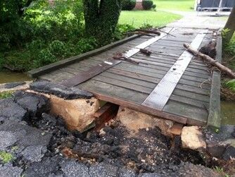
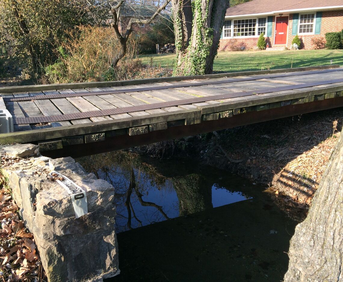
The Overbrook neighborhood in Towson, Baltimore County is located along the headwater reach of Herring Run, a watershed fully developed prior to laws requiring stormwater management and prohibiting development in the floodplain. Several of the houses in the neighborhood were located in close proximity to the channel and well within the 100-year floodplain, and as a result, found their yards and homes flooded with up to 3 feet of water in multiple events over the course of 3 years’ time. Residents of the community reached out to the County for assistance in how to address this ongoing threat to safety and property integrity.
The areas of the watershed upland of the community were all developed in the early-mid 20th century, leaving very little undeveloped land on which to construct stormwater quantity management to mitigate the flood threat. The channel reach in question was approximately 1500’ long and the proximity of the homes to the channel banks themselves did not allow for significant widening or floodplain grading to increase channel capacity.
HOW WE HELPED
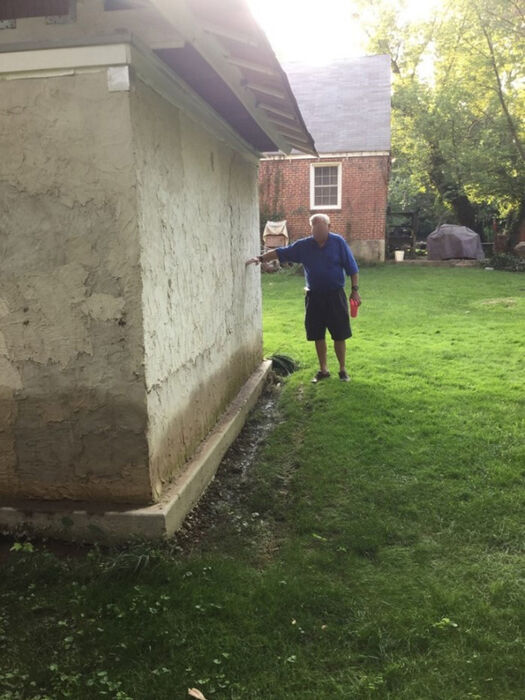
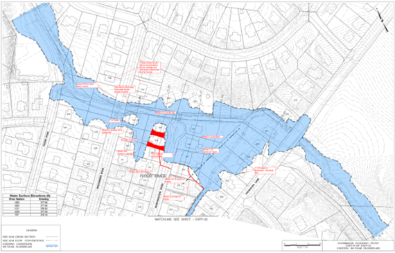
McCormick Taylor completed a detailed site reconnaissance to evaluate the reach’s condition and establish a strategy for subsequent field investigations, survey needs, and modeling inputs. The effort included observations of infrastructure, stream crossings, and other structures within each study area. Engineers developed NRCS-based hydrologic models for the existing (fully developed) land use conditions. Discharges for seven recurrence-interval events were developed for input into the HEC-RAS water surface profile model. Under proposed conditions, McCormick Taylor developed the hydrologic analysis necessary to divert excess runoff to a stormdrain system from the tributary under Stevenson Lane as one of the possible options. HEC-RAS sections were based on a combination of field survey, County GIS, and site visits. The HEC-RAS model was used to establish existing-development conditions and to provide water surface elevations along the reach for 2, 10, 50, 100 and 500-year frequency events. Geo-Referenced HEC-RAS models for all riverine flood models were prepared.
McCormick Taylor prepared a comprehensive Flood Study Evaluation Report that fully documented the hydrologic and hydraulic models, inputs, analysis, and results as well as including all backup calculations. Report exhibits included drainage area mapping, floodplain mapping, cross-sections, and stream profiles. The report also provided references to previous studies and compared similarities and differences within the models. Numerous improvement options were developed and analyzed as six alternatives by modifying the HECRAS model to reflect the existing and proposed conditions. Detailed cost estimates, including utility impacts, were developed for each component of the alternatives, and cost-benefit analyses based on cost vs. reduction of flood frequency and elevation were assembled and prioritized for consideration by the county and community in a series of informational meetings.
McCormick Taylor provided additional support for this initiative through:
- Development of public meeting presentation materials
- Interviews with affected residents
- Participation in and presentation during numerous public meetings
RESULTS
In order to justify the acquisition and demolition of residential properties by the County, it was crucial to develop a thorough cost-benefit assessment of all possible alternatives to assure there were no other reasonable mitigation approaches that could notably reduce the risk of future flood events. Six main alternatives were examined, including the purchase of affected properties, and several permutations of structure replacement and channel grading improvements. Dissemination of the results of the study to the community during a public meeting was conclusive enough to result in an immediate offering by numerous residents to sell their properties to the County and relocate during the meeting. Several properties were ultimately purchased and razed, making them available for increasing the floodplain through this reach as well as for inclusion in an ongoing County Greenway project.