SR 50, SECTION A28 PROJECT
BRIDGEVILLE BOROUGH & SOUTH FAYETTE TOWNSHIP, PA
McCormick Taylor worked closely with the Pennsylvania Department of Transportation, Engineering District 11-0 to complete the preliminary engineering and final design of the project and provide construction consultation services. The team’s approach utilized 3D digital design, public engagement, and Accelerated Bridge Construction (ABC) techniques to efficiently deliver the project, minimize traffic disruptions and property impacts, and maximize vehicular, pedestrian, and community improvements.
THE CHALLENGE
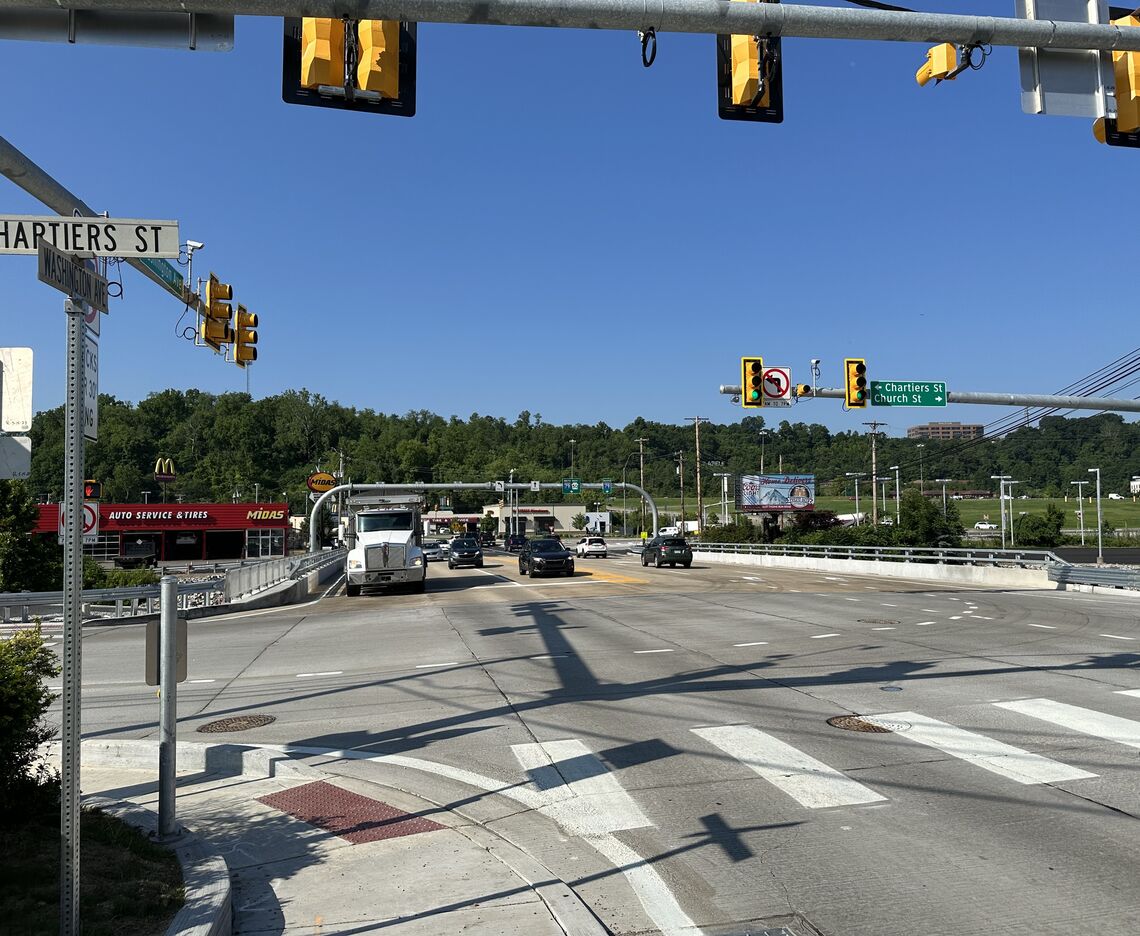
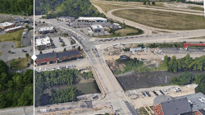
The SR 50, Section A28 project is located adjacent to the Interstate 79, Bridgeville Interchange (Exit 54) in Bridgeville Borough and South Fayette Township, PA. The project limits include a portion of Chartiers Street from SR 50 to a bridge spanning the railroad, the intersection of Chartiers Street/SR 50/Church Street, the SR 50 Bridge over Chartiers Creek, the eastern part of the SR 50/Millers Run Road intersection, and the I-79 northbound on-ramp. The purpose of the project was to improve the condition of the SR 50 Chartiers Creek Bridge; address capacity deficiencies, congestion, unacceptable levels of service, safety concerns; and improve ADA accommodations/sidewalk connections.
To do so effectively and efficiently, a number of constraints were considered and regular coordination with the established Route 50 Task Force occurred throughout project development. The project was first initiated by the Task Force - a partnership between five local municipalities, Allegheny County, EQA Landmark Development (Newbury), state government officials, and the Southwestern Pennsylvania Commission (SPC). Their partnership helped to get the project funded and facilitated the development of initial conceptual improvements. Constraints included several adjacent businesses, the historic Bethany Presbyterian Church, and numerous utilities including natural gas, gas pressure regulator station, multiple aerial poles, water, underground fiber optic cable, and sewer. The project is also located within a detailed FEMA (Zone AE) 100-year floodplain and Chartiers Creek is within the James G. Fulton Local Flood Protection Project, which is regulated by the Army Corps of Engineers. The project team was required to maintain the 100-year water surface elevation without any increase as a result of the SR 50 improvements.
HOW WE HELPED
The McCormick Taylor team provided environmental support, conducted traffic analyses, led the roadway and structural engineering, conducted a hydraulic analysis, developed the traffic control staging for construction, managed utility coordination, assisted with right-of-way acquisition efforts, obtained environmental permits, and facilitated public and agency coordination.
Highlights of these activities are included below:
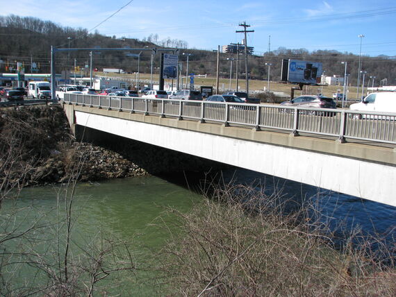
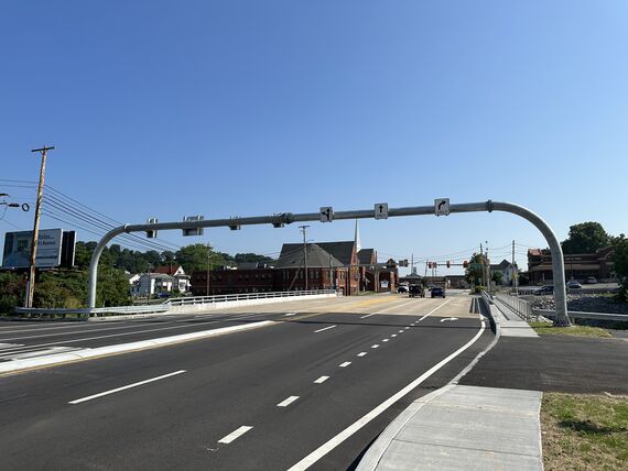
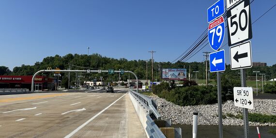
- The previous four-lane bridge template was widened to seven lanes to reduce congestion and queuing and to better accommodate current and projected future traffic. Three lanes in the northbound direction were added to include an exclusive right turn lane to access Chartiers Street and two through-lanes. Four-lanes were added in the southbound direction to include an exclusive right turn lane to access the northbound I-79 ramp, providing direct access to the ramp; a right turn lane to continue on SR 50 (Millers Run Road), which provides access to the southbound I-79 ramp; a single southbound through-lane; and an exclusive left turn lane to access the Crossings at South Fayette shopping area.
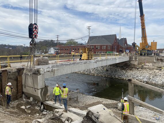
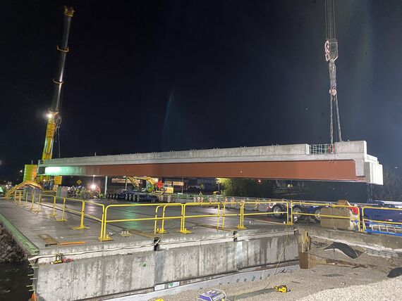
- Due to extremely high traffic volumes (25,000 ADT) and the commercial nature of the project area, ABC techniques were incorporated into the overall project design to: minimize user impacts by building bridge elements offsite and transporting to the bridge location; improve total project delivery time, mobility and work-zone safety for the traveling public; and limit the detour duration to three weekends.
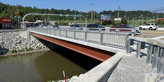
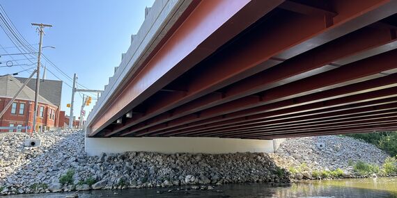
- The existing single-span adjacent box beam bridge superstructure was replaced half-width within two weekend closures using staged ABC techniques. The bridge (half old and half new) was reopened to traffic in the week between weekend closure periods. ABC elements utilized to expedite construction included: new modular superstructure units (each consisting of steel two-girder sections with a precast concrete deck), precast concrete abutment caps and precast concrete sleeper slabs. The existing abutments were reused and widened using conventional construction techniques in the year leading up to the closure while traffic was maintained on the existing bridge.
- The superstructure depth was reduced in the widened condition to prevent impacts to the 100-year water surface elevation.
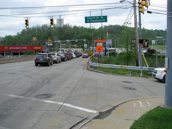
- Chartiers Street was widened to include an exclusive left turn lane to access SR 50 westbound and one lane allowing all directional movements.
- Traffic signals were upgraded at SR 50/Washington Pike and SR 50/Chartiers Street/Church Street to accommodate the new lane configuration.
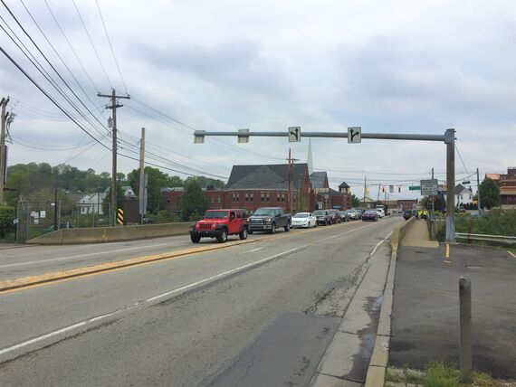
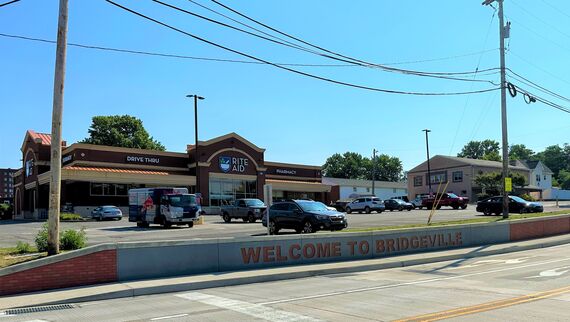
- Sidewalks with ADA ramps on both approaches to the bridge were included. Enhancements to the sidewalk along Chartiers Street were incorporated in coordination with the Task Force and the Bethany Presbyterian Church. This included a moment slab retaining wall with an aesthetic concrete surface treatment consisting of a brick color and pattern matching the historic Bethany Presbyterian Church and a “Welcome to Bridgeville” message.
- A thorough Public Involvement Program was incorporated including stakeholder meetings, meetings with local officials, and two meetings to solicit input from the general public on the design.
- To accommodate pedestrians during construction, a pedestrian shuttle was used to transport pedestrians from one side of the detoured bridge to the other to ensure pedestrian safety while providing uninterrupted access.
RESULTS
The completed SR 50, Section A28 Project provides a safe and efficient crossing of Chartiers Creek, while improving operations and safety at the intersections of SR 50 with Washington Pike and Chartiers Street. Construction methods incorporated into the project design successfully minimized traffic disruptions during construction. Construction activities restricting traffic were specified to occur during the work week from 9 AM to 4 PM to minimize disruption to the typical AM and PM peak traffic. ABC techniques were utilized to expedite construction and limit the detour duration to three weekends. Two designed construction access roads (one at each abutment) were created to facilitate contractor access, while ensuring the elevation and width of the access roadways would not be detrimental to the Chartiers Creek floodway. The project was let for construction in 2021 and the bid was within 2% of McCormick Taylor’s pre-bid design estimate.
AWARDS
2023 ABCD Pittsburgh Outstanding Single Span Bridge
2024 ASHE Pittsburgh Project of the Year, Category B, greater than $10M and less than $30M
| 1 of 3
| 2 of 3
| 3 of 3