HOW WE HELPED
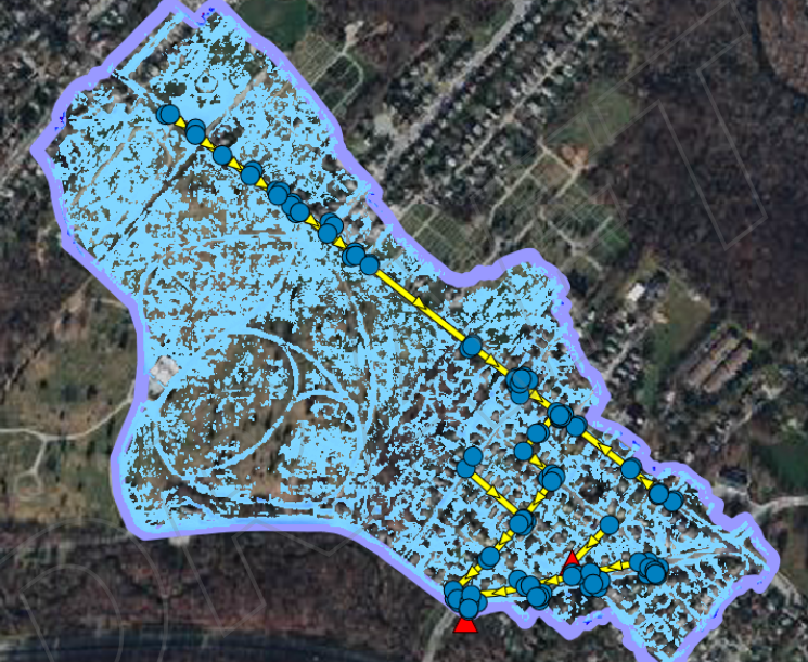
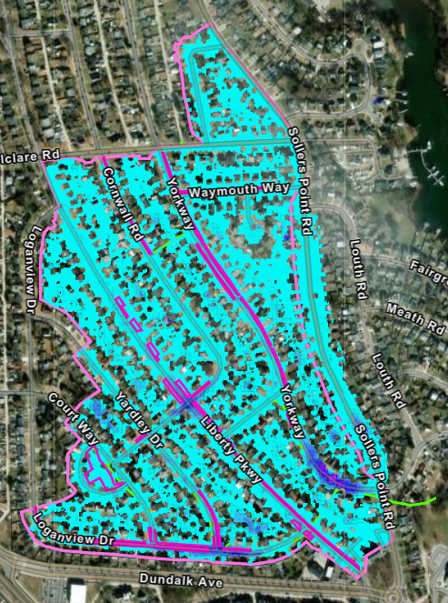
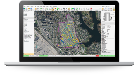
McCormick Taylor was asked to develop the methodology for a capacity-based LOS analysis of existing storm drain systems, considering individual watersheds based on larger storm drain networks that outfall into waters of the US. For the initial pilot project, six watersheds throughout the County were chosen to reflect the diversity of location, terrain, and development throughout the County. After brainstorming efficient ways to calculate hydrology on such a large scale that it could be applied county-wide but also accessible enough to be reproduced by a large team of consultants and County personnel alike, McCormick Taylor suggested the PCSWMM software platform as the basis for this portion of the larger storm drain asset tool. The tool utilizes existing GIS data and as-built information to the maximum extent possible, supplementing with field measurements to address data gaps, to build a model of the existing infrastructure within a 3-dimensional terrain environment.
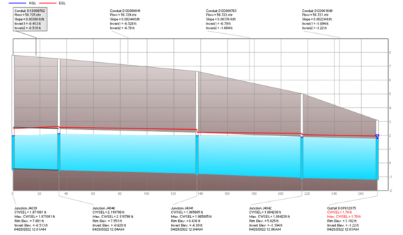
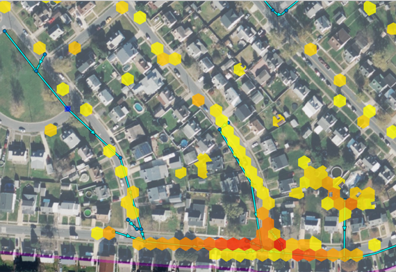
A rain-on-grid approach is utilized with the existing data to determine runoff to the various entry points (inlets, headwalls, etc.) in the system as well as localized depth and extent of surface ponding. The system further analyzes the storm drain capacity and hydraulic grade line for a range of design storms such that the LOS can be determined, and areas of insufficient capacity and likely flooding are identified. The methodology is scalable and adjustable to consider variations in precipitation intensities, inlet parameters, existing storage (stormwater, green infrastructure), and the developed protocols reproducible to apply county-wide. Output data can be combined with other storm drain risk data related to structural inspection, drainage complaints, maintenance, etc. as part of the comprehensive assessment needed to prioritize maintenance, capital improvements, and proposed locations for green and grey drainage infrastructure retrofits.
McCormick Taylor provided additional support for this initiative through:
- Development of protocols and web-based guidelines to reproduce the process for future watershed assessments and troubleshoot development and results.
- Development of training to inform use of the tool and protocols.
- Coordination with the Storm Drain Asset Management and Prioritization Framework team to assure compatibility with the larger database and tool development.
- Updates to County GIS data resulting from field data and research to address data gaps.