What do you enjoy most about your role as a GIS Developer?
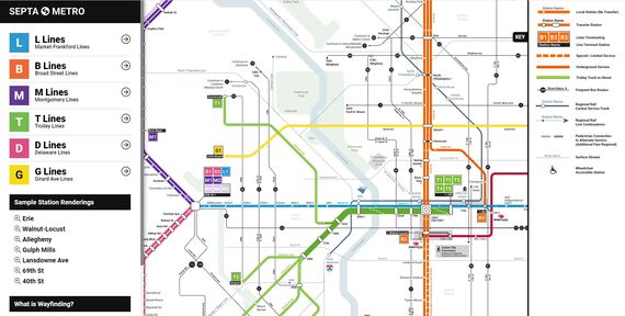
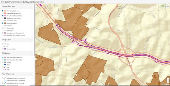
I enjoy building custom web maps the most. Sometimes the out-of-the-box Esri map templates and solutions don’t work for the need. Custom webmaps require creativity which allows for a personal touch. Some neat custom web maps I created have been SEPTA Metro, SR 299 Improvements tour, and the NJDOT Map Maker tool. The use of my “GIS Dashboard” maps has been especially helpful on large projects such as the Mon/Fayette Expressway Project and I-70 Reconstruction.
Can you tell us about the range of projects you work on daily?
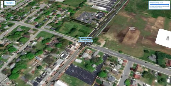
In any given year I touch 40-50 different projects at McCormick Taylor and I have worked with staff in almost all our offices. Daily work for me can be digitizing GIS data, making report print maps, analyzing and calculating archaeology predictive models, writing website code, setting up field data collection maps, and sometimes I get to do graphic design work in software like Adobe Illustrator!
How does GIS help facilitate project delivery and community engagement?
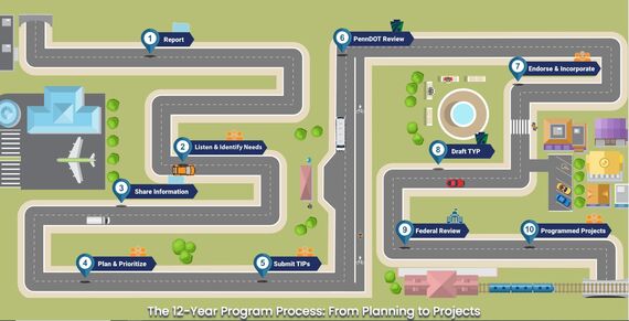
Maps and charts are a form of visual communication. So much of our work includes the questions of where, what, why, and how much. I create the visuals to help people understand those aspects of our work. I especially like taking complex data and making it digestible or insightful. I created the first version of the 12-Year Program Process infographic which has been a big hit with PennDOT over the years.
How have you seen GIS Technology change over your career and where do you see it going?
GIS technology and web technology have changed a lot over my career. Staying up to date with it all can be a challenge. Web GIS, with cell phones and tablets didn’t exist when I started. The future of GIS is to put the power within the disciplines and get away from the GIS staff doing all the data creation and editing work. GIS data sharing and quality continue to improve every year and finding better ways to get data quicker is the future.
You’ve been providing GIS services at McCormick Taylor for nearly 10 years. What’s kept you here throughout your career?
I am a fully remote worker living in Vancouver, Washington. The flexibility, work-life balance, the interesting projects, the people, and pay keep me around. I can easily say McCormick Taylor has been the best place I have ever worked. I feel like leadership has good values and vision, and sincerely cares about the staff.