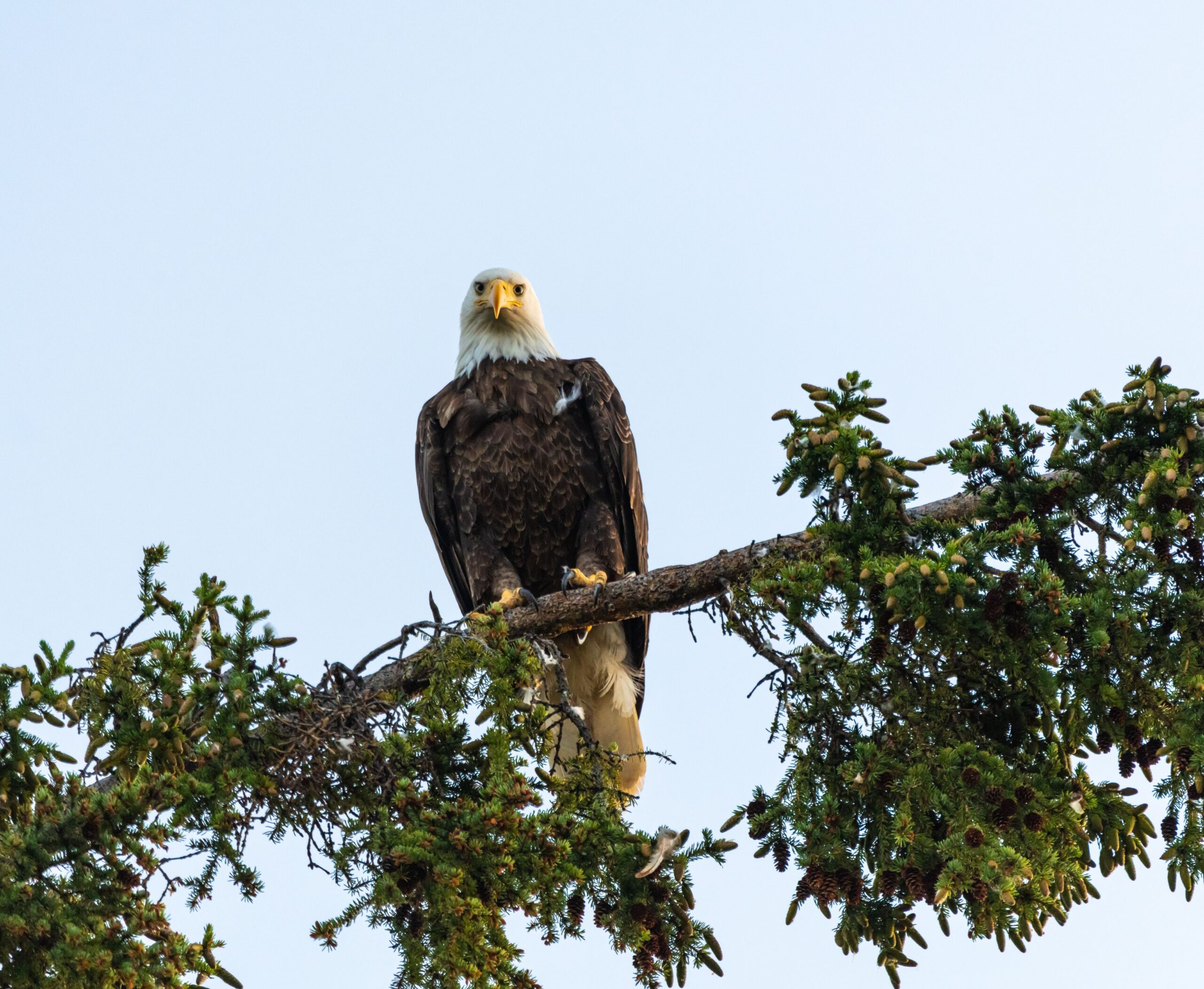
Beyond being an iconic emblem of the United States, bald eagles play an important role in many freshwater, mountain, and forest ecosystems. As “ecological indicators”, bald eagle population fluctuations often signal larger environmental problems that may affect other species, including humans.
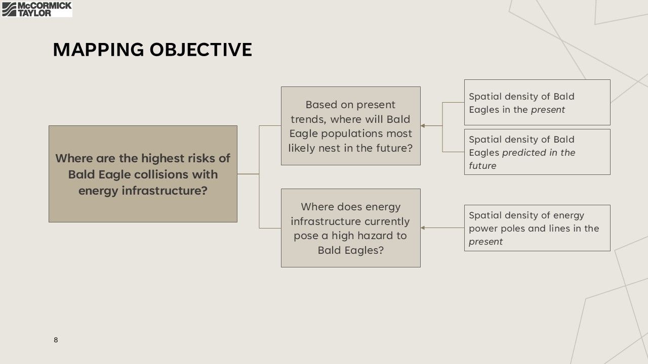
The United States Bald and Golden Eagle Protection Act prohibits any disturbance to bald eagles that kill, injure, or displace them from their nests. As energy companies plan new infrastructure or retrofitting for existing facilities, they often must take measures to comply with these regulations and safeguard bald eagle habitats. A team of biologists, planners, and Geographical Information Systems (GIS) analysts at McCormick Taylor were tasked with predicting the presence of bald eagle nests across seven northeastern states for an energy client to help inform future infrastructure-related decisions. The team’s final model resulted in a 92% accuracy rate across the seven states. Read more about the data utilized, variables considered, and environmental indicators implemented into the model in the sections below.
Part 1: Landscape Analysis On Existing Nesting Data
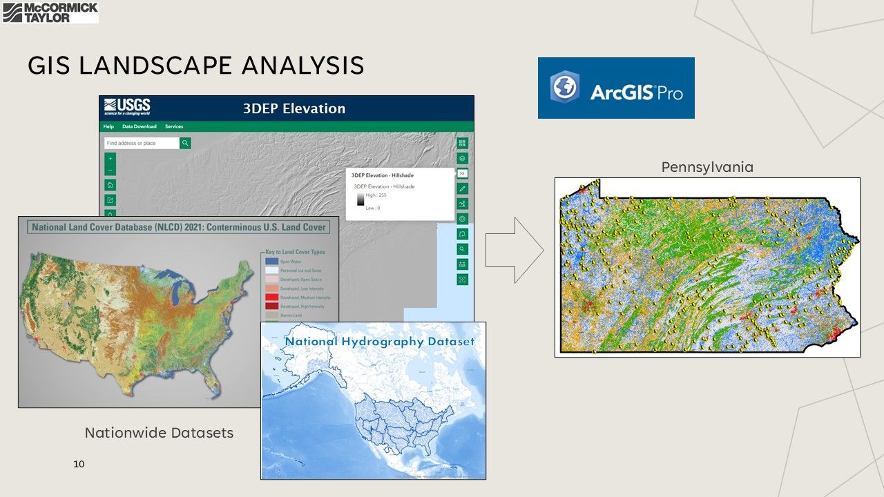
Knowing that a training dataset would be essential for developing the model, the team began by focusing its initial GIS landscape analysis on Pennsylvania, a state with rich geographic diversity and a robust, publicly available bald eagle nest location dataset. The goal of this first phase was to identify environmental datasets and variables that could serve as predictors of nest presence.
Guided by the company’s biologists, the analysts concentrated on two key environmental factors known to influence bald eagle presence: access to food sources and the availability of suitable nesting habitat. For food sources, the team used the National Hydrography Dataset (NHD) to represent bodies of water, refining it to include only perennial streams and waterbodies larger than one square kilometer—features assumed to provide more stable food supplies. They also used the National Land Cover Dataset (NLCD) to represent agricultural areas via the “Hay/Pasture” land cover category and extracted medium- and high-intensity development areas to evaluate whether nest presence is negatively correlated with human development.
To identify potential nesting habitat, the team used U.S. Geological Survey data on tree height and forest type to locate tall trees with good sightlines, conditions favored by bald eagles for building nests.

Part 2: Building The Predictive Model
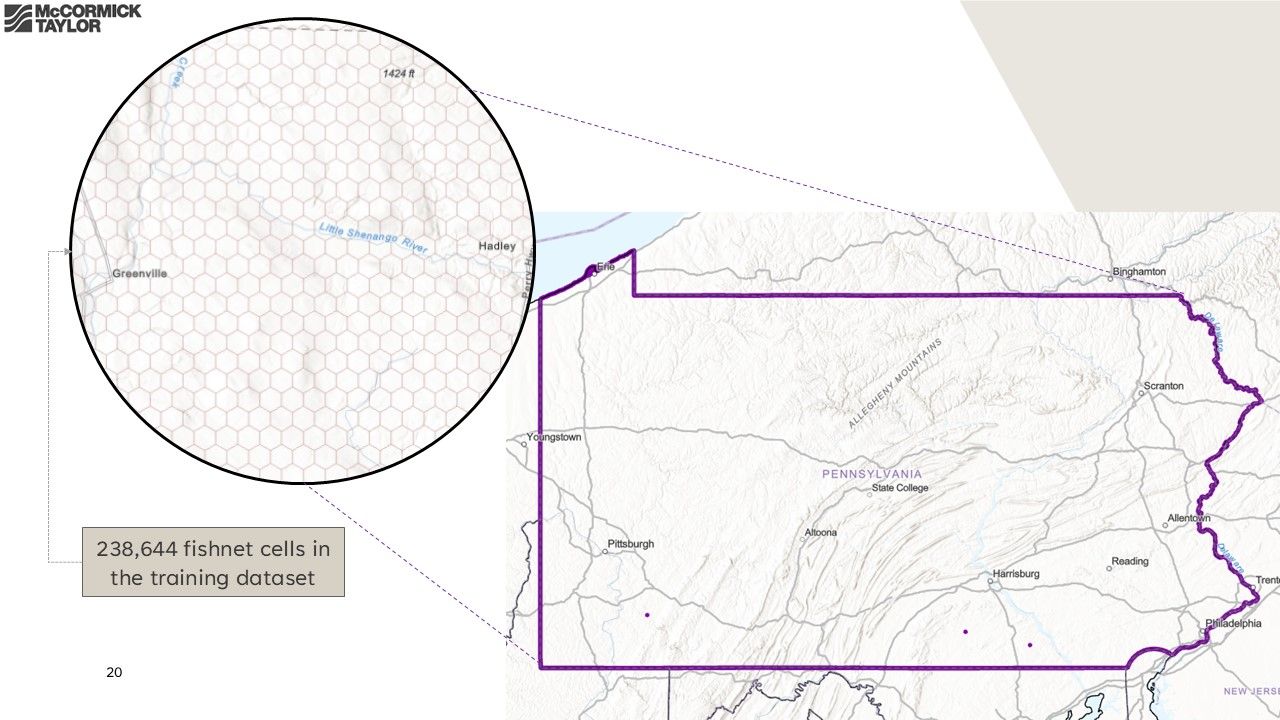
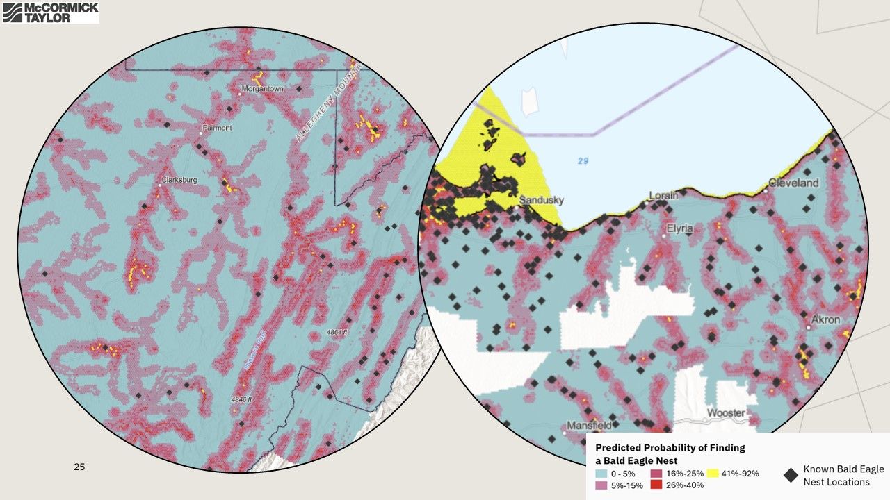
The training dataset teaches the model to recognize data patterns in locations where nest sites are already known. The team created a fishnet across Pennsylvania. Each 1000-meter-wide “cell” contains a unique land and environmental distribution. The team used regression analysis to understand the potential causal relationship between the habitat and environmental indicators and the known nest locations. Once the best-fit model was established, it was then used to predict nest locations in areas that have well-defined environmental indicators but no documented nest sites.
Part 3: Results And Next Steps
The completed model was compared to known nesting sites across seven states and demonstrated a 92% accuracy rate in predicting bald eagle nest presence. The model was used by the client to better inform their hazard and risk assessments associated with future infrastructure decisions, supporting their compliance with Bald Eagle Protection Act regulations.
Bald eagles are an important part of many ecosystems, but they are far from the only animals in need of protection; similar methodology could help predict the presence of other vulnerable species across the United States. Principles from this project may also be applied to a variety of other important developmental planning considerations such as flood prevention or growth management.
For more information about McCormick Taylor’s Environmental and GIS services, contact Sean Doig.